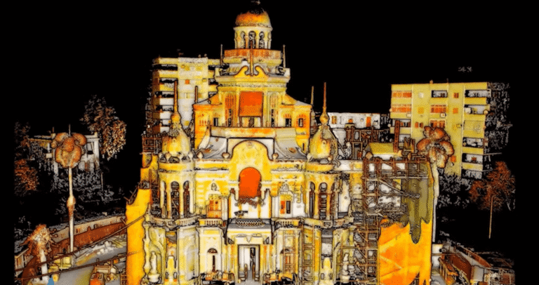
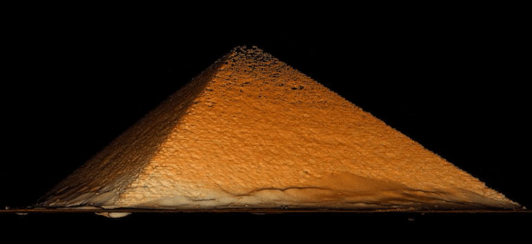
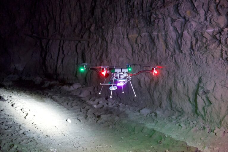
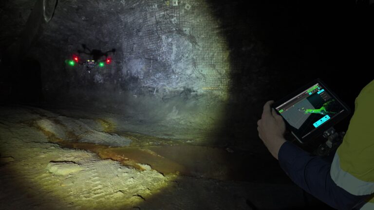
Resource Center Filter by Use CaseResource TypeIndustry Videos El Sakakini Palace, Cairo Videos Pyramids of Egypt Videos AI-Powered Autonomous Exploration Videos How to capture a stope using autonomous exploration Videos Open pit mine scan Videos Best Practice for Automated Ground Control Points Videos Saint John’s Anglican Cathedral – Brisbane, Australia Videos Best Practices for Scanning Challenging Environments Videos Hovermap mine tunnel scan Videos Approaching JC Slaughter Falls trail – Brisbane, Australia Videos Grandstand Scan – captured in 15 minutes Videos Handheld scan – former steel mill, Pennsylvania, USA Videos Truckee River Flume – LiDAR vs Photogrammetry Videos Hovermap oil and gas drill rig scan Videos Interior Scan – Captured in 5 minutes Videos Mapping the UQ Green Bridge Videos How UDM Group reduced capture from days to hours Videos Hovermap Data in PointCab Origins Videos Importing Hovermap Data into PointCab Origins Videos Hovermap metro station scan Videos Trafikverket Scan Videos Hovermap indoor stockpile scan Videos Hovermap storage tank internal scan Videos Hovermap Porsche Museum scan Videos Hovermap Scan of Uppsala Cathedral Videos Hovermap Building mapping and facade inspection Videos Jakarta Mass Rapid Transit Videos Scan to BIM Videos Scan to BIM – Elevator Shaft Videos Hovermap bridge scan to BIM Keep up with all the latest at Emesent SUBSCRIBE NOW